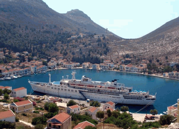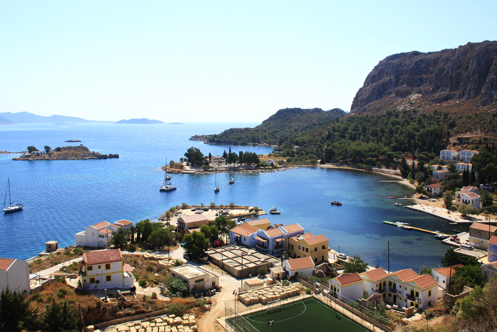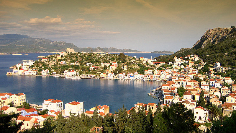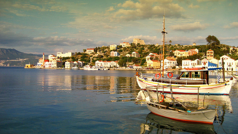
Kastellorizo, the only settlement of the island, is both the harbor and the capital of the island. It consists of the districts Pigadia, Horafia and lastly Mandraki (small picturesque port). The picturesqueness of the scenery upon arrival on the island, cannot be easily described. The painted in impressive colours two and three story renovated mansions with their wooden staircases and balconies, make it unrivalled in beauty amongst other islands. The town has been proclaimed preserved and it offers the visitor the beauty of an idyllic landscape and the nostalgia of a past glory. In past times the capital, which is also the port of the island, wasthe most important geophysical gift of Kastellorizo, since due to its geophysical position it was a trade crossroad between Europe, the Middle East and Egypt. It was only natural that it generated an important amount of economic and nautical trade which explains the noble air about the island that reflect its past glory and prosperity. On the island there are no buses - just one taxi! Car and motorcycle circulation is prohibited and you will cover all distances on foot. The well-preserved foot paths are ideal for long walks. You will swim on Faros, Plakes, Mandraki and the beaches of the islets of Ro, Aghios Georgios and Strogilli.
KASTELLORIZO HISTORY

The first version is considered more accurate and Strabo calls the island Kisthene. It is as much as two miles far from the Asia Minor coast of Lycia, facing Antifellon – once Greek and now a Turkish village - it is of triangular shape with a length of 6km and a width of 3km thus resulting to an area of 9,2km ² . There are three capes, St Stefano, Nifti and Ponente at the South. It is a mountainous rock-island, barren and arid, with only a few small trees and surrounded by rock-islets which look like ducks on the water when seen from a distance.
The island has been inhabited since the ancient times of Neolithic and meso minoic ages. Then, Dorians settled there, as they did on all Dodecanese islands. This rock-island had its own civilization, judging from ancient findings, inscriptions, tombs, walls, ruins of the temple of Apollo Megisteas whose worship was spread all over the island and to the nearby coast of Asia Minor, as well. At Patara, for instance, a temple of supreme beauty was built having inside a statue of the god and coins were in circulation with the god's head on one side and on the other a rose and two capital letters standing for Megisteon. Another sign of the island's civilization is the golden crown of excellent artistry that was found at the island and nowadays is exhibited at the Museum of Athens .
The only town is built around the large and safe port which is located between the capes of St Stefano and Nifti. Megisti participated into the expedition to Troy along with the rest of Dodecanese and, being allied with the Athenians, helped them with the war against Persia . In 300 B.C. the island broke away for a while from its big “sister” Rhodes, but soon returned under its rule, following the steps of other 12 islands. Later it passed to the possession of Romans and after that it was captured by the Byzantines, to end up to the Knights of St John of Rhodes in 1306. The pirate raids from the coasts of Africa and Asia Minor wouldn't leave the island in peace. Every so often, in order to save themselves, the people would run to the castle that was built by Sossikleas Nikagoras and reconstructed by Ferdinand d'Erentia (1377-1396). The latter was the eighth Big Magister of the Knights of Rhodes and in the castle he walled his majestic coat of arms which represented seven golden towers. Those towers, together with the greatly high, twin walls and the loopholes, made the castle one of the strongest fortresses of the Aegean Sea . Since then Megisti changes its name with the foreign word Kastellorizo, which derives from the words Castello-Rosso, because of the red-colored high rocks on which the castle is built.
So, in time, the new name dominated in ancient Megisti which had a wondrous port, greatly sought after by both foreign and domestic fleets, either as a base of operations, or as a shelter. Because of the port and the strong fortress of St. Nicholas – which prevails over the port and the city –and due to its prominent geographic position, it was quite often the target of predatory pirates and powerful despots.
In 1440, the Egyptian Armada bombarded the castle and the island was seized. Helped by the King of Spain Alfonso and Pope Nicholas E', the Franks took it back. But in 1522, they were forced to leave the island for good, when Sultan Suleiman the Majestic captured our islands with his fleet. Megisti was subjected to the rule of the new master without resistance; it only paid an annual tax ( maktou ) and maintained the privileges of religion and language, as well as its national tradition. At that time, its merchant fleet had a prominent place among the merchant shipping of Dodecanese .
A new raid, however, stopped the progress. In 1659 the Venetians seized the island, but the Turks took it back again. In July 1788, the heroic “sea-eagle” Lambros Katsonis attacked them like tornado with 1150 armed men and 14 big guns – according to tradition, in the castle where the Turks entrenched themselves, there was also Katsonis' fiancée Maria Sofianopoulou, who was a prisoner of the Algerians.
Katsonis set out at night from Lycia on his cruiser “ATHINA TIS ARKTOU” along with other ships under his command and with 20 big guns, and came to seize Kastellorizo. After having bombarded the castle he launched a surprise attack against the Turks, killing a lot of them and tearing the fort down. In view of the dashing attack of the Greeks, the Turks raised a white flag and surrendered the fortress together with their arms to Katsonis. The Greek Metropolite saw to the safe going of those Turks to Asia Minor . During that period, the merchant ships of Kastellorizo were flourishing and the islet enjoyed its greatest prosperity. When the Greek War of Independence was declared in 1821, the men of Kastellorizo sent their families off to the islands Kassos-Karpathos-Amorgos because they were afraid that the Turks would slaughter the Christians.
The island was left deserted, with its full-of-wealth stately homes. The men, after they had secured the women and children, threw themselves into the war and were among the first to offer their vessels for fire ships. They went out to the sea together with Kanaris, Vokos (Miaoulis), Voudouris and Apostolis to chase the enemy, fighting bravely and gloriously. When Greece became independent after the successful uprising of 1821, it was believed that the Dodecanese would also be delivered from the Turks. The London Protocol (1830), however, provided that the Dodecanese should be placed under Turkish rule and, instead of Samos and the Dodecanese , Greece would be given Euboea . Kastellorizo resigned to its fate but did not lose its shipping dynamism. On the contrary, it not only prospered in merchant and shipping business, but made a remarkable progress in literature, as well. It was then that famous Schools were founded, such as the Sandrapeia School – of the benefactor Lucas Sandrapes – where literacy and education were given to many generations. Magnificent churches were built, with rich iconography and sumptuous icon screens, such as the cathedral of St Constantine and St Helena , St George of Lucas, St George Pegadiotis and some smaller ones, as well as plenty of monasteries and country churches.
A Turkish governor (“kaimakamis”) with a small staff was present there during the period of Turkish rule, just for the sake of appearances – because virtually, the power was exercised by the local elders, enlightened people with a profound feeling for Greece , who kept tradition and national consciousness alive. So, there came a time when Kastellorizo was one of the most blissful islands of the Dodecanese , with riches and gentility, due to the large fleet of sailing ships and the most profitable voyages thereof. In 1909, the sailing ships owned by our compatriots, were as follows: a) Barque – bestia, three-masted, 15 b) Brigs, 30. c) Schooners and light fast sailing – boats, 45. d) Luggers, 35. e) Latinia – Fishing vessels etc., 60. The island numbered 12-14,000 inhabitants at that time, most of which (of the men) were seamen. In March 1913, when the people saw that the Greek fleet was taking the islands of the Aegean Sea – which were not occupied by the Italians – rose up against the local Turkish authorities. Helped and supported by 35 Cretans, who with their chieftain Manolis Daskalakis at the head had arrived on the steamboat ‘ROUMELI”, they seized the island in the name of King George A'. The Turks put up no resistance. In August, Vassilios Tzavellas settled in Kastellorizo as governor-counselor. The enslaved for centuries islet, celebrated its deliverance with unrestrained enthusiasm, but not for long In three years' time, the French came, abolished the Greek authorities and installed themselves in the unfortunate Kastellorizo. In 1920, they handed it over to the Italians. Admiral Morneux lowered the French flag and Admiral Galeani hoisted the Italian one.
From that fateful and dark moment onwards, the noble island was plunged into mourning and grief. Its great cultural progress as well as its shipping and trade declined and many inhabitants, unable to put up with the Italian yoke, started to expatriate; the population decreased to about 2,000. When 600 British soldiers disembarked on Mandraki in February 1941, people thought that the time had come for Dodecanese to be saved. The fascists that were entrenched in Paleokastro, surrendered without resistance when the British came. Houses and ships were decked with flags and bells rang. The joy, however, did not last long because two days later, Italian bombers forced the British to abandon the island and the fascists took it back. Mourning and terrorism went on for two years and in September 1943, an army of occupation disembarked from the Greek destroyer ‘Pavlos Kountouriotis”, without resistance from the Italians – Armistice between Italy and the Allied Powers. The population did not proceed to demonstrations but observed that new disembarkment with anxiety, as if they had a presentiment of something. Two months later, German airplanes bombed the island; the planes that were coming from Rhodes in waves, fought against the planes of the Allied Forces, thus completing the destruction. Almost all the houses that had still been standing collapsed and the few people that had remained on the island left it, either because of fear or after an order of the British commanding officer. Those people, after evacuating the island, passed through Cyprus and Turkey and sough refuge in Sahara ( Palestine ), where some 14,000 ex-inhabitants of Samos and Dodecanese got together and stayed in tents for two years. Then, they started back homeward, but their sufferings would not end yet. The third – and last – expedition from Palestine , about 300 people, left Port Said on board the Austria ship “EMPIRE PATROL” in October 1945. Sixty miles away from the port, around 10 a.m. , the ship caught fire. During the disaster, 35 lives were lost, the rest were picked up by ships – that hastened there to help – and were carried back to Port Said .
Then, they were moved to El Sat where they were given medical care and two months later they were sent to their destroyed island. After two years in exile, however, they faced a strange place and were unable to locate their homes, dwellings, shops and churches. Once a happy island, now completely derelict. The island remained under British government for another two years – like the rest of the Dodecanese – and in March 7, 1947 it was annexed to Greece and remains Greek since then.
Kastellorizo SITES/MUSEUMS

The sites to be seen are:
The Castle of the Knights of the order of St. John dating back to the 14th century.
The perfectly preserved stone-hewed Lycean tomb underneath the castle at the port entrance.
Palaiokastro - the eldest site on Kastellorizo island. There you will see the remains of ancient buildings, water cisterns and neolithic tools.
The Metropolis of St. Constantine and Helen - the saint patrons of Kastellorizo island.
The archaeological Museum.
The famous Aqua-colored Cave of Kastellorizo is one of the rarest geological phenomena and one of the most amazing formations on Earth; Kastellorizo is worth visiting just for this cave only. This panoramic sea cave is also known with the name “Parastas hole” or “Fokiali” – due to the seals ( fokia ) that live inside – and it is the most phantasmagoric cave of the Mediterranean Sea . It is said to be superior to the “CROTTA AZZURA” of Capri near Naples , Italy , as Victor-Emmanuel the King admitted when he visited it in 1929. It is situated at the SE coastal region of the island, it is 75m long (inside), 40m wide and 35m high, and the entrance is as high as a small boat – which can just pass through the mouth when the sea is calm at dawn. The calm waters of the cave look like an immense blue-green mirror with plenty of iridescence, which seems to illuminate this enormous fairy-like palace, the numerous stalactites and the thousands of wild pigeons, with various colors.
Kastellorizo Sailing/Yachting information
You can moor your boat in the port of Kastelorizo.
Refuelling stations for both water and fuel are available on the island.
Transportation on Kastellorizo island
By bus (very frequent schedules), taxis, rented cars, motorcycles or little boats you will visit the villages and beaches of the island.
Kastellorizo Festivals/Feasts
- St. Paraskevi June 26th
- St. Helen & Constantine (island's saint patrons) May 21st
- Assumption of Virgin Mary August 15th
- Prophet Elias
Kastellorizo Excursions
Boats are on hand to take you to the nearby islets of Ro and Strogili.
Both islands have wonderful beaches. Ro became famous when its sole inhabitant, the lady of Ro, used to raise the Greek flag there every morning.
Kastellorizo Beaches
Though there are no beaches as such on Kastellorizo island, you can take a little boat to the particularly beautiful blue cave of Parasta (Fokiali).
There is also excellent swimming from the rocks near the port.
Kastellorizo island useful information
Area code: +30 22460
Harbourmaster: 45220
Police: 45213
Municipality: 45207
First Aid: 45206

Kastelorizo (officially Megisti) is a Greek island located in the southeastern Mediterranean. It lies roughly 2 km off the south coast of Turkey, and 125 km east of Rhodes, almost halfway between Rhodes and Antalya. Kastelorizo is part of the Rhodes region.
Coordinates: 36°9′N 29°35′EPhoto left: Satellite picture of Kastelorizo, Dodecanese, Greece
The meaning of its current official name Megisti is “biggest” or “greatest”, but it is the smallest of the Dodecanese. The name, however, refers to the fact that it is the largest of the small archipelago.
The meaning of its current official name Megisti is “biggest” or “greatest”, but it is the smallest of the Dodecanese. The name, however, refers to the fact that it is the largest of the small archipelago.


Δεν υπάρχουν σχόλια:
Δημοσίευση σχολίου